Four Roads Decide Which Beautiful Places California Shows You
California runs about 800 miles north to south, and four corridors carry almost everything worth stopping for: Highway 1 on the coast, US-101 inland from it, Interstate 5 down the middle, and US-395 along the eastern edge of the Sierra Nevada. Pick one. The beautiful places California is famous for cluster along these roads, and crossing between them costs you a day or, for half the year, isn’t possible at all.
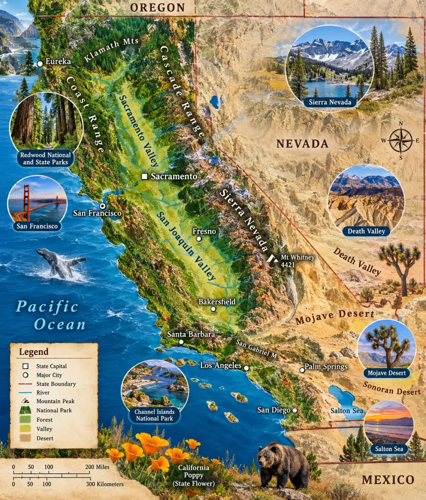
That last part surprises people. The Sierra has very few crossings and most of them close with snow.
Highway 1 Is Open Again, With Asterisks
The Big Sur coast spent three years in pieces. Paul’s Slide cut through-traffic in January 2023, then Regent’s Slide buried 6.8 miles of road in February 2024.
Caltrans reopened the final segment on January 14, 2026, roughly 90 days ahead of schedule after an $82 million repair. Then winter storms eroded debris into the catchment below the slope and the same stretch closed again in February.
Since then it’s been open with intermittent one-way signal control at maintenance zones. The McWay Falls overlook trail has stayed closed for retaining wall work.
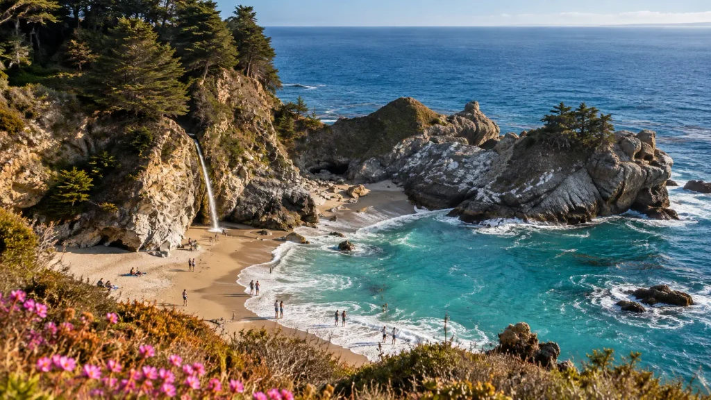
None of that means skip it. It means check before you drive. The USGS has mapped more than 1,500 landslides along 75 miles of this coastline, so this isn’t a one-time repair, it’s the permanent condition of the road. Live conditions are on the Caltrans QuickMap.
What’s along it: Bixby Creek Bridge, Pfeiffer Beach with its purple sand and keyhole rock, Point Lobos State Natural Reserve just north in Carmel, and Hearst Castle at San Simeon further south. Elephant seals haul out at Piedras Blancas year round, and the viewing boardwalk there is free with no reservation. Peak season for pups runs January and February, when the beach is loud enough to hear from the parking lot.
Drive it northbound if you can. Southbound puts you on the inside lane and away from the ocean.
US-395 Is the Best Road in the State
This is the corridor almost no visitor drives, and I’d rank it above Highway 1 for pure scenery per mile.
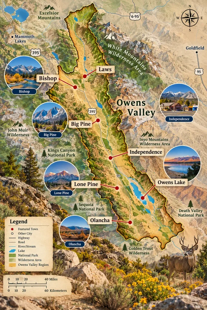
US-395 runs up the eastern flank of the Sierra with the range wall rising straight out of the Owens Valley to your west. It’s high desert on one side and 14,000-foot granite on the other, for hours.
What’s on it:
- Alabama Hills near Lone Pine, a field of rounded granite boulders where hundreds of westerns were filmed, with Mount Whitney behind it
- Mono Lake near Lee Vining, an ancient saline lake with limestone tufa towers rising out of the water
- Bodie State Historic Park, a gold rush town preserved in arrested decay with no restoration and no gift shop polish
- Convict Lake and the June Lake Loop, both short detours off the highway
- Mammoth Lakes, which is a ski town in winter and a trailhead in summer
The kicker: Badwater Basin in Death Valley sits 282 feet below sea level, and Mount Whitney tops out at 14,505 feet. They’re roughly 85 miles apart. Nowhere else in the lower 48 compresses that range.
Go in fall. September and October give you clear air, open passes, and aspens turning gold in the canyons off 395.
Beautiful Places California Strings Along US-101
The 101 corridor is the one people drive without realizing it’s the scenic option.
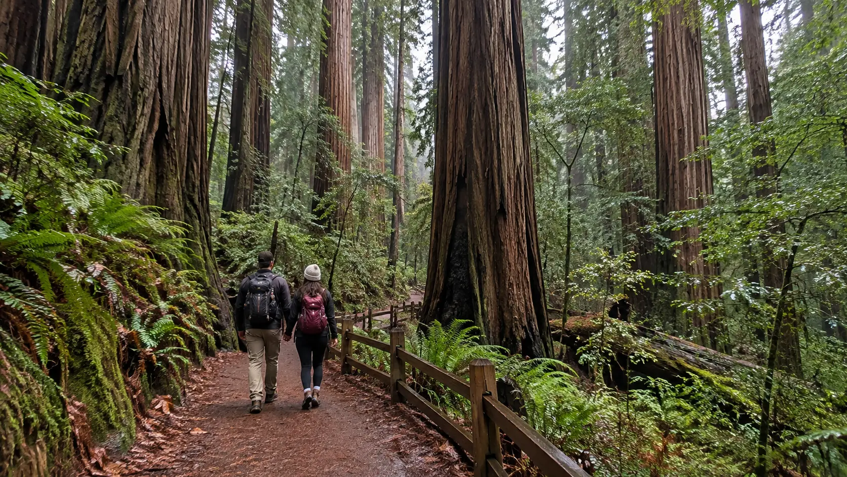
North of San Francisco it runs through Sonoma County wine country, then into the redwoods. Humboldt Redwoods State Park holds the Avenue of the Giants, a 31-mile alternate route parallel to the highway through old-growth coast redwoods. It’s free and it’s better than most paid attractions in the state.
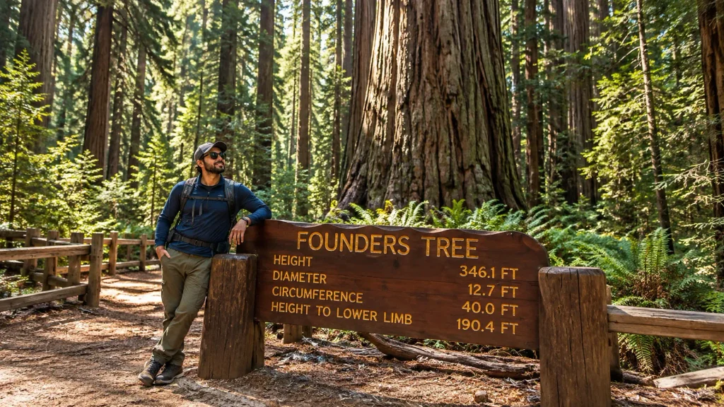
Further north, Redwood National and State Parks near Crescent City protect the tallest trees on earth. Fern Canyon in Prairie Creek Redwoods State Park requires a summer permit and has 50-foot walls covered entirely in ferns.
South of the Bay, 101 runs inland through the Salinas Valley and is mostly agricultural until Santa Barbara.
The Lost Coast sits west of 101 in Humboldt County, where the mountains proved too steep to build a highway through. It’s the longest stretch of California coast with no road, and reaching it takes commitment, a tide table, and a permit if you’re backpacking the Lost Coast Trail.
Redwood park information sits at nps.gov/redw, and the parks there are jointly managed by the National Park Service and California State Parks, which is why the name is plural.
Park details are at California State Parks.
I-5 Is for Getting There, With Three Exceptions
I’ll be blunt: the Central Valley stretch of I-5 is one of the dullest drives in America, and it exists to move you between Los Angeles and the Bay Area in six hours.
Three things justify an exit:
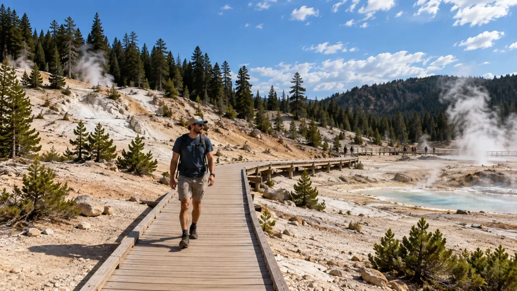
Mount Shasta dominates the northern section, a 14,000-foot volcano that appears alone on the horizon for an hour before you reach it. Lassen Volcanic National Park sits east of the highway with hydrothermal features and almost none of Yellowstone’s crowds. And Sacramento‘s Old Town is a reasonable lunch stop if you’re already passing.
Otherwise, take 101 if you have the extra ninety minutes. The scenery difference is enormous and the time cost is small.
Crossing the Sierra Is a Seasonal Privilege
This is the mechanic that reshapes California itineraries and almost no guide explains it.
The Sierra Nevada runs roughly 400 miles with very few vehicle crossings, and the high ones close every winter. In 2026: Monitor Pass opened March 5, Sonora Pass April 30, Ebbetts Pass May 6, and Tioga Pass on May 15, having closed the previous November 12.
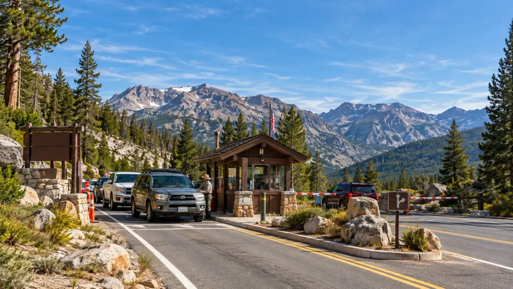
Tioga is the one that matters most. At 9,943 feet it’s the highest pass in the range, it carries State Route 120 through Yosemite National Park, and it’s the direct link between the eastern Sierra and Yosemite Valley. It’s also the last to open every year.
What that means practically:
- From roughly November to late May, Yosemite and US-395 are separate trips. The detour around the range runs for hours.
- Opening dates move by weeks depending on the snowpack. Don’t book a June itinerary assuming Tioga is open.
- Wildfire closes passes too, sometimes with no notice in late summer.
- Yosemite required no day-use reservations for 2026, a change from prior years. Verify at nps.gov/yose before you plan around it.
The Desert Runs on the Opposite Calendar
While the Sierra is buried, the desert is at its best, which is the scheduling gift most visitors miss.
Death Valley National Park is a pleasure from November through March and dangerous from June through September. Badwater Basin, Zabriskie Point at sunrise, and Mesquite Flat Sand Dunes all work in winter. Conditions are at nps.gov/deva.
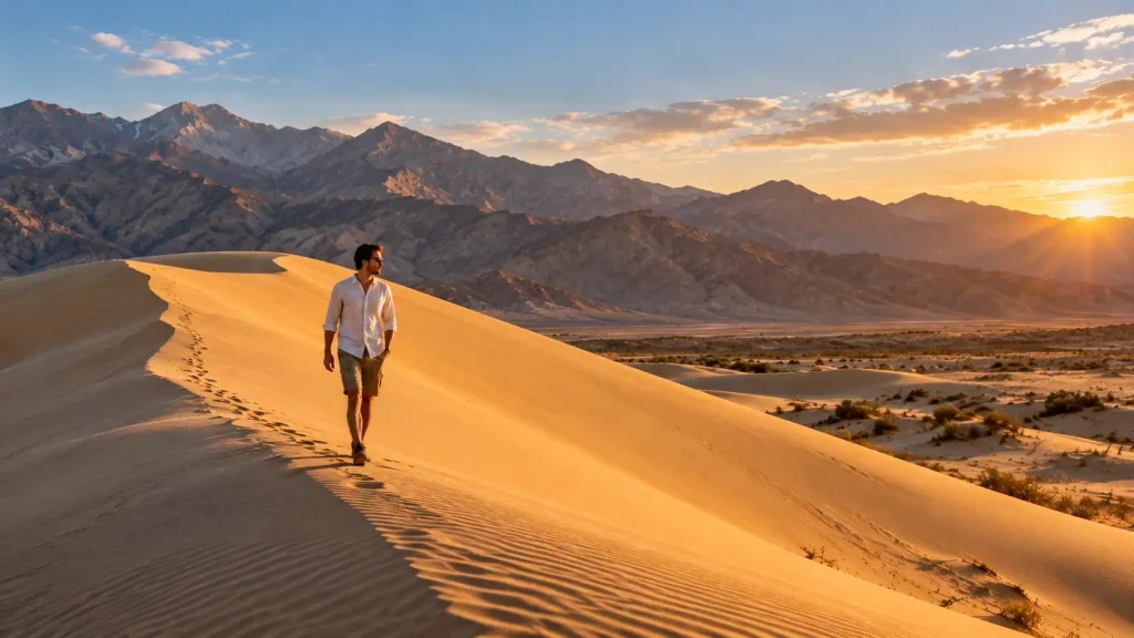
Joshua Tree National Park and Anza-Borrego Desert State Park follow the same pattern. Anza-Borrego is the state’s largest state park and produces a wildflower bloom in wet springs, though the bloom depends entirely on winter rainfall and fails in dry years.
So a December California trip isn’t a compromise. It’s a different state, and arguably the better half.
Distances Californians Take for Granted
Underestimating drive time is the single most common planning error here.
- Los Angeles to San Francisco: about 6 hours on I-5, closer to 9 or 10 on Highway 1
- San Francisco to Crescent City: roughly 7 hours
- Los Angeles to Death Valley: about 4 hours
- Yosemite Valley to Mono Lake via Tioga: under 2 hours when open, 5 or more when closed
- San Diego to the Oregon border: 12 to 14 hours straight through
Pick one corridor for a week. Two corridors need ten days. Three is a driving vacation.
What I’d Book
If you have a week and it’s summer, drive 395 from Lone Pine to Mammoth, cross Tioga into Yosemite, and finish in the Bay Area. That single route gives you desert, the highest mountains in the lower 48, granite domes, and a city.
If it’s winter, do Death Valley and Joshua Tree, and leave the Sierra alone.
And if it’s your first visit and you only want the postcard, take Highway 1 from Monterey to Cambria over two days, checking the QuickMap the morning you leave.
One thing I’d avoid entirely: trying to see Yosemite as a day trip from San Francisco. It’s four hours each way to the valley, the shuttle system eats another hour, and you’ll spend more time driving than looking. Stay in Mariposa, Groveland, or inside the park.
Questions Travelers Send About California Routes
Is Highway 1 through Big Sur open?
It reopened on January 14, 2026, after a three-year closure caused by Paul’s Slide and Regent’s Slide, though storm debris forced another closure that February and one-way signal control has been in place at maintenance zones since. Check the Caltrans QuickMap before driving.
When does Tioga Pass open?
Typically late May or June, depending on the snowpack. In 2026 it opened May 15 after closing on November 12, 2025. At 9,943 feet it’s the highest pass in the Sierra Nevada and usually the last to clear. Late-season storms can close it temporarily after opening.
What is the most scenic drive in California?
Highway 1 through Big Sur is the famous answer, but US-395 along the eastern Sierra delivers more scenery per mile and far fewer people. It runs past Alabama Hills, Mono Lake, and Bodie with the Sierra crest rising 10,000 feet above the valley floor.
When is the best time to visit California?
September and October statewide. Passes are open, wildfire risk drops after the first rains, desert temperatures moderate, and coastal fog clears. Winter suits the deserts and closes the high Sierra. Summer works for the mountains but brings heat and crowds everywhere else.
How many days do you need in California?
Seven for one corridor, ten for two. Los Angeles to San Francisco alone is six hours on I-5 and nearly double that on Highway 1. Trying to combine the coast, the Sierra, and the desert in a week produces a driving trip with scenery visible through glass.
Do you need reservations for Yosemite?
Not for day use in 2026, which reversed the policy of prior years. The park has changed this repeatedly, so confirm on the official Yosemite site before planning. Lodging inside the park still books roughly a year ahead and sells out regardless of entry rules.
Draw the Route First
The beautiful places California protects are spread across 800 miles and four roads, which is why destination-first planning falls apart here. Open a map and pick your corridor before you pick a single stop. That decision does more to shape a California trip than choosing between Yosemite and Big Sur ever will.
Then check two things the morning you leave: the QuickMap for Highway 1 and slide conditions, and the pass status if your route crosses the Sierra. Both change fast enough that a week-old answer is worthless.