Volcanoes to Visit in USA, Ranked by How Hard You’ll Work to See Them
The best volcanoes to visit in USA run from a parking lot view to a 10-mile slog through loose ash. Kīlauea on the Island of Hawaii, inside Hawaii Volcanoes National Park, is the only one erupting right now, and you can’t schedule it.
Everything else here is dormant, which makes it safer and easier to plan. Start with the alert level, then pick your level of suffering.
Check the Alert Level Before You Book Any of the Volcanoes to Visit in USA
The U.S. Geological Survey (USGS) rates every monitored volcano on a four-step ladder. The rating tells you what you’ll see, and what might be closed.
- Normal: quiet. Most places in this guide sit here.
- Advisory: unrest above background. Some trails may close, but nothing is erupting.
- Watch: an eruption is underway or likely. Kīlauea has held here during its recent summit episodes.
- Warning: a hazardous eruption is imminent or happening. Stay away.
Pilots get a matching scale, the Aviation Color Code (green, yellow, orange, red). You’ll see both on every USGS notice.
Check the USGS Volcano Hazards Program a week before you fly and again the morning you go. Alert levels change fast, and park roads follow them.
Kīlauea in Hawaii: Plan the Trip Around the Volcano, Not the Fountains
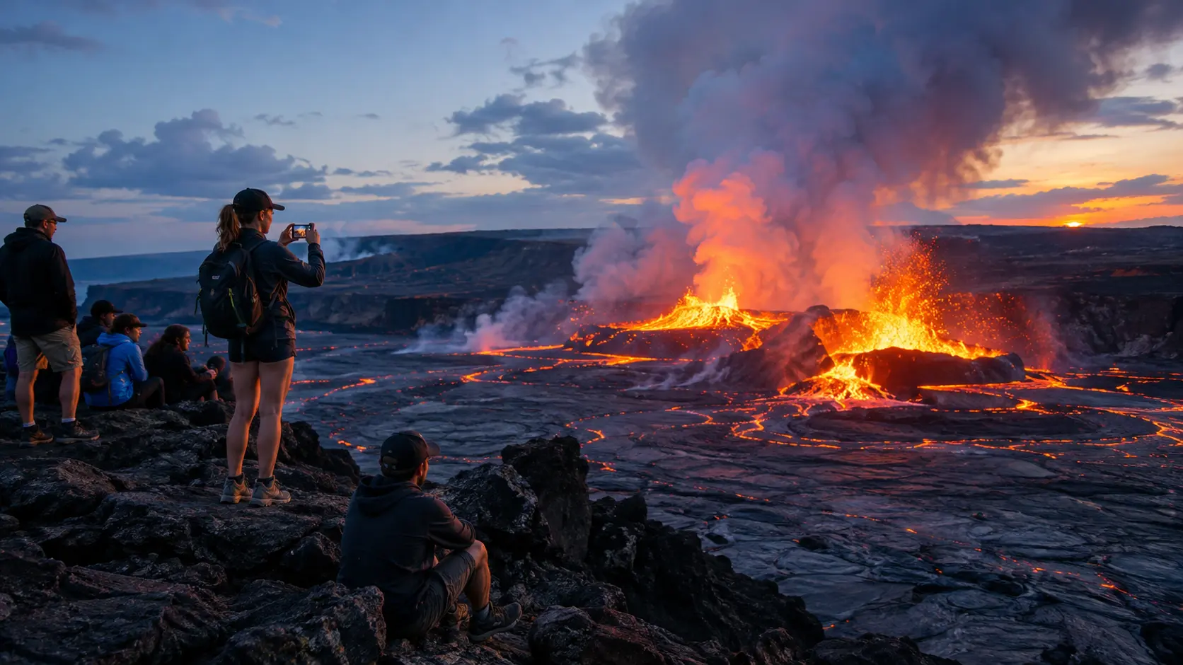
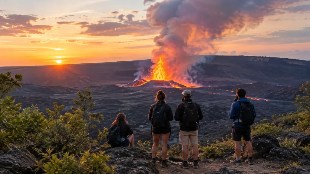
Since December 23, 2024, the summit eruption in Halemaumau crater has run in episodes. Each one throws lava fountains hundreds of feet high. Most last a day or less.
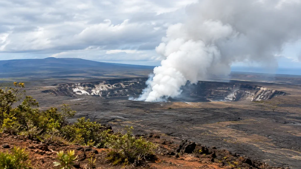
That’s the catch. You can fly 5,000 miles and land between episodes. I’d budget three days on the island, not one, and treat any fountaining as a bonus. The park sits about 30 miles from Hilo, Hawaii, and roughly two hours from the Kona side.
Where you sleep matters more than it sounds. The small town of Volcano, Hawaii, sits minutes from the park entrance, so you can be at an overlook at dawn. Hilo has more restaurants and cheaper rooms, but it adds about 45 minutes each way. I’d pick Volcano for the first night, then move if you need variety.
Watch the USGS Hawaiian Volcano Observatory cameras and the National Park Service page for Hawaii Volcanoes each morning. Viewing happens from overlooks along Crater Rim Drive. Gas and fine glass particles drift downwind, so anyone with asthma should check conditions first.
The Quiet-Day Backup: Kīlauea Iki
When nothing’s erupting, walk the Kīlauea Iki Trail. It’s a loop of about 4 miles that drops roughly 400 feet onto a crater floor still steaming from a 1959 eruption. Plan two hours, and wear shoes with grip. The lava rock chews up sandals.
Three Volcano Hikes in the USA, From Pleasant Stroll to Punishing Slog
Easy first: Kīlauea Iki, above. Then Lassen Peak. Then the one that’ll wreck your legs, Mount St. Helens.
Lassen Peak, California: Moderate, With a Smell
Lassen Peak (10,457 feet) rises inside Lassen Volcanic National Park in northeastern California. The trail runs about 5 miles round trip with roughly 2,000 feet of gain. I’d budget four hours, and I’d start early because afternoon thunderstorms build fast.

Snow can linger on the upper switchbacks into July. The volcano last erupted from 1914 to 1917, and its steaming vents still smell like rotten eggs. The Bumpass Hell boardwalk, about 3 miles round trip, puts you beside boiling mud pots. Check the Lassen Volcanic National Park site for road openings, since the park road shuts under snow for much of the year.
Mount St. Helens, Washington: The Hard One
Mount St. Helens blew its top on May 18, 1980, and the summit now stands near 8,300 feet. The summer route, Monitor Ridge, starts at Climber’s Bivouac (3,700 feet) in the Mount St. Helens National Volcanic Monument, which the U.S. Forest Service manages. Expect about 10 miles round trip and roughly 4,500 feet of gain.

Above treeline, you scramble over lava boulders, then slog through pumice that slides back under every step. Most people need 8 to 12 hours. Pack gaiters, 3 liters of water, and a headlamp.
You need a permit to travel above 4,800 feet, all year. From April 1 through October 31, you book it on Recreation.gov. Permits are released monthly, and the first day of the preceding month is the date to watch. Entering the crater is prohibited.
Weather turns fast above treeline. Whiteouts happen even in summer, and the route is hard to follow when clouds close in, so turn around if you can’t see the next marker. Summiting isn’t worth a bad descent.
If you don’t want to climb, drive to the Johnston Ridge Observatory on State Route 504 instead. It looks straight into the crater from about 5 miles away.
Crater Lake and Haleakalā: Volcanoes You Can See From a Parked Car
Short answer: Crater Lake wins for scenery, and Haleakalā wins for views of the stars.
Crater Lake, Oregon
Crater Lake National Park in southern Oregon fills the collapsed caldera of Mount Mazama, which fell in roughly 7,700 years ago. The lake reaches 1,943 feet deep, the deepest in the country. The 33-mile Rim Drive circles it, and you can do the whole loop in a few hours with stops.

The one legal way to touch the water is the Cleetwood Cove Trail: 1.1 miles each way, with about 700 feet of climbing on the way back. It’s steeper than it looks.
Skip June. Snow keeps stretches of Rim Drive closed until around July, and late-summer wildfire smoke can flatten the blue. I’d go in mid-September.
Haleakalā, Maui
Haleakalā National Park on Maui, Hawaii, centers on a dormant volcano whose summit reaches 10,023 feet. Sunrise requires an advance reservation on Recreation.gov. I’d skip it. The line of headlights at 4 a.m. in near-freezing air isn’t worth it when sunset is easier and less crowded.

Bring a real jacket. You’re 10,000 feet above a beach.
Lava Tubes and Cinder Cones: Three Cheap Stops in the West
These cost little and take half a day each.
- Newberry National Volcanic Monument, near Bend, Oregon: the Lava River Cave is a mile-long lava tube that stays around 42°F year-round. Bring a jacket, and reserve ahead in summer.
- Craters of the Moon National Monument and Preserve, near Arco, Idaho: black lava fields with almost no shade. Climb the Inferno Cone for the view.
- Sunset Crater Volcano National Monument, near Flagstaff, Arizona: a cinder cone that erupted about 1,000 years ago. You can’t climb it anymore, but the 1-mile Lava Flow Trail loops through the rubble.
Yellowstone Is a Volcano, but Not the One You’re Picturing
Yellowstone National Park, in Wyoming, Montana, and Idaho, sits on a caldera roughly 30 by 45 miles wide. There’s no cone to climb. You see the volcano’s heat in geysers, hot springs, and mud pots.
It’s a great trip, just not a volcano hike. Don’t pick Yellowstone for crater views.
Volcanoes in the U.S. That Could Erupt, and Whether That Should Change Your Plans
No. The USGS tracks about 160 potentially active volcanoes in the country, and a smaller group earns its “very high threat” label. Mount St. Helens, Mount Rainier, Mount Shasta, and Mauna Loa are on that list.
The score measures what sits downstream, not the odds of an eruption this week. Mauna Loa last erupted in 2022, its first in decades.
Mount Rainier, in Washington, worries scientists most because of lahars, fast volcanic mudflows that could reach towns in the valleys below. You can still hike the Skyline Trail from Paradise at normal alert levels. Just learn the evacuation routes on arrival.
Volcanoes in the U.S. by State, in Plain Terms
For a visual, open the USGS map of U.S. volcanoes. Here’s the short version by state:
- Hawaiʻi: Kīlauea, Mauna Loa, Haleakalā.
- Washington: Mount St. Helens, Mount Rainier, Mount Baker.
- Oregon: Crater Lake, Newberry, Mount Hood, the Three Sisters.
- California: Lassen Peak, Mount Shasta.
- Idaho: Craters of the Moon.
- Arizona: Sunset Crater, the San Francisco Peaks near Flagstaff.
- Wyoming: Yellowstone Caldera.
- Alaska: most of the country’s historically active volcanoes, including those in Katmai National Park and Preserve.
Alaska is where I’d say skip, unless you have a week and a floatplane budget. Most of those volcanoes are remote and have no trails.
Pack for Cold, Grit, and Sulfur
- Layers. Haleakalā’s summit is near freezing before dawn, and Lava River Cave stays around 42°F.
- Gaiters for ash and pumice on Mount St. Helens.
- Closed-toe shoes with real tread for sharp lava rock.
- A headlamp for caves and early starts.
- Water. Most volcano trails have none.
Snow Shuts Half of These Volcanoes Until July
July through September is the safe window for Crater Lake, Lassen, and Mount St. Helens. Kīlauea and Haleakalā work all year, though Hawaiʻi’s wet season brings cloud cover and rain.
Budget-wise, an America the Beautiful pass pays for itself across three national park stops. Check current prices before you buy. Lava tubes and cinder cones are the cheapest stops, and Mount St. Helens costs only the permit and a tank of gas.
With kids, stick to Kīlauea Iki, Sunset Crater’s Lava Flow Trail, and Crater Lake’s Rim Drive. Mount St. Helens isn’t a family climb, and I’d save it for teens who already hike long days. To avoid crowds, go midweek. Haleakalā at sunrise and Crater Lake on a July weekend are the two spots where timing makes the biggest difference.
For a loop, I’d drive the Pacific Northwest in this order: Mount St. Helens, then Crater Lake, then Lassen. Each leg is roughly four hours down Interstate 5. Give Hawaiʻi its own trip.
Questions I’d Answer Before You Book a Flight to a Volcano
Can you see lava in the USA?
Yes, at Kīlauea in Hawaii Volcanoes National Park, where the summit eruption has produced lava fountains in episodes since December 2024. Most episodes last a day or less, so plan three days on the Island of Hawaiʻi and check USGS and National Park Service updates each morning instead of booking around one date.
What’s the easiest volcano hike in the USA?
Kīlauea Iki in Hawaiʻi Volcanoes National Park, a loop of about 4 miles that crosses a crater floor, takes roughly two hours, and has only about 400 feet of elevation change. For a drive-up option, Crater Lake’s Rim Drive in Oregon and Sunset Crater’s Lava Flow Trail in Arizona need no real climbing.
Do I need a permit to climb Mount St. Helens?
Yes. Climbing above 4,800 feet requires a permit year-round, and from April 1 through October 31 you book it in advance on Recreation.gov. Permits release monthly and sell out on summer weekends, so check the first day of the month before your climb. Entering the crater is prohibited.
Which U.S. volcano is most likely to erupt next?
Kīlauea is already erupting, and Mauna Loa last erupted in 2022. The USGS ranks Mount St. Helens, Mount Rainier, and Mount Shasta as very high threat, but that score reflects what sits nearby, not a forecast. Quiet volcanoes like these are monitored and safe to visit at normal alert levels.
Book the Mount St. Helens Permit First, Then Everything Else
Pick one hard climb, one easy one, and Kīlauea. Reserve in that order: permits and sunrise slots first, lodging second, flights last. They vanish before rooms do.
If I could keep only one of the volcanoes to visit in USA, it’d be Lassen. Fewer crowds, real hiking, and a steaming mud pot at the end.